Four dimensions
A 2025 review groups school bikeability indicators into cycling infrastructure, connectivity/urbanisation, safety and surrounding environment.
Read the review ↗02 · ACTIVE TRAVEL / SCHOOL ACCESS
A Bristol–Utrecht comparison that starts with cycling infrastructure, then asks a more human question: does the network create a connected, safe and usable school journey?
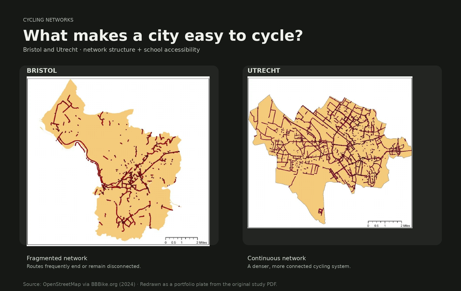
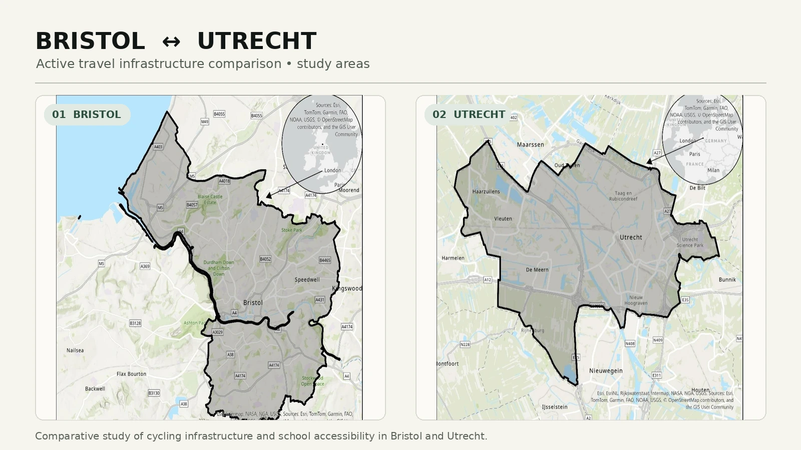
The supplied Active Travel Project compares Bristol and Utrecht through cycling-network structure and school accessibility. For the portfolio, the question is reframed around the child’s journey rather than the infrastructure count: can a school trip be made through a connected network?
The original maps show a different spatial structure in Bristol and Utrecht. The redesigned plate removes the surrounding report furniture so the network itself becomes the evidence.
A network is only useful for school travel when it reaches the places children actually need to go. The supplied project uses a 300 m buffer around primary schools to test this immediate relationship.
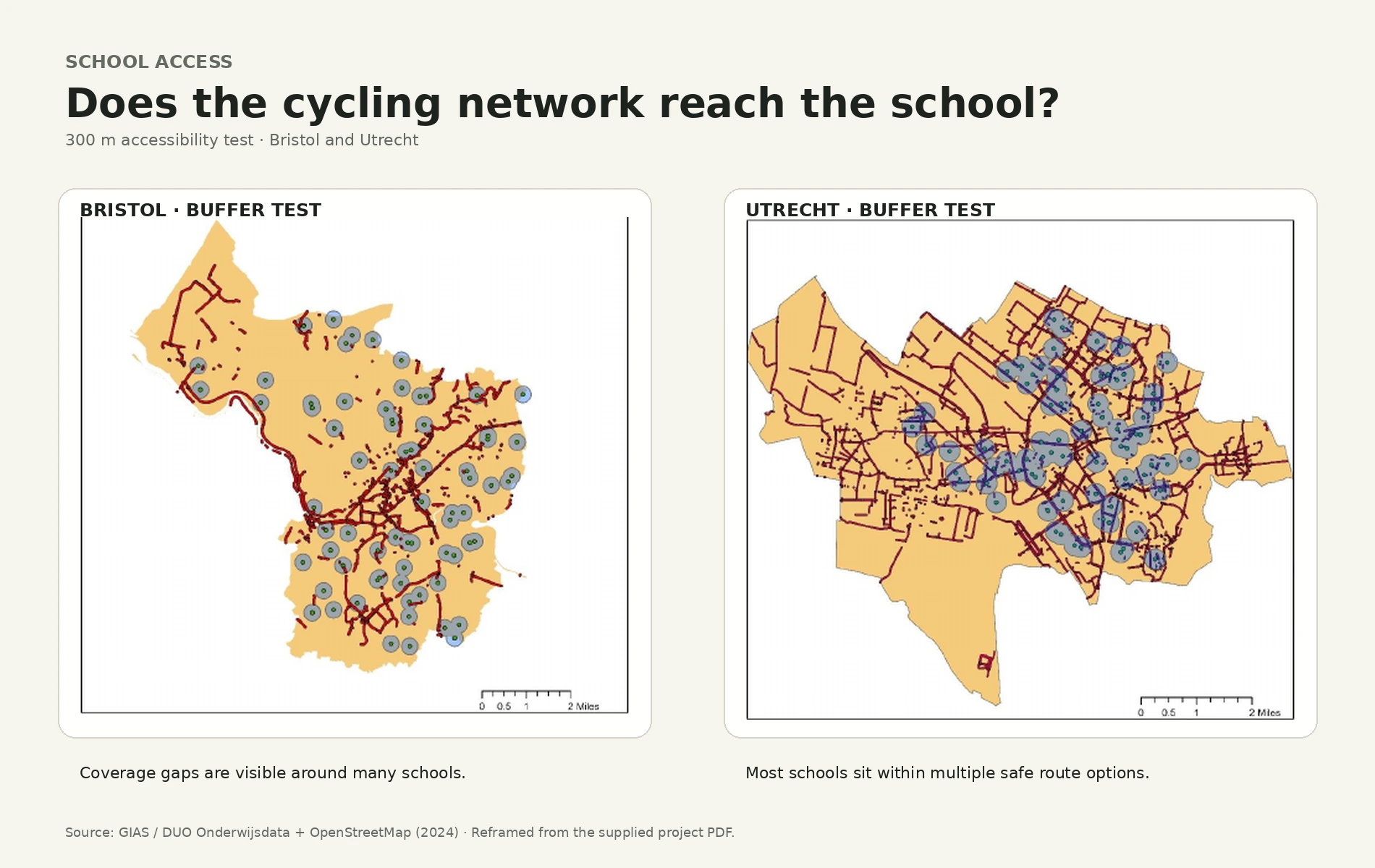
In the supplied study, 35% of Bristol primary schools had direct access to protected cycling infrastructure within the 300 m threshold. This is a finding from the project’s analysis—not evidence that infrastructure alone determines whether a child cycles.
Recent research helps place the map in context. It does not prove a Bristol–Utrecht causal relationship, but it supports a broader school-bikeability lens around infrastructure, connectivity, safety, distance and social environment.
A 2025 review groups school bikeability indicators into cycling infrastructure, connectivity/urbanisation, safety and surrounding environment.
Read the review ↗A 2026 Dutch study of 878 parents found parental encouragement and peer cycling were associated with greater likelihood of cycling to school; longer perceived distance reduced it.
Read the study ↗A Dutch GPS-based study found well-connected streets and cycling lanes were positively associated with active school travel, highlighting the role of the built environment.
Read the study ↗External research is contextual evidence; the Bristol/Utrecht map findings remain based on the supplied Active Travel Project PDF.
The original project remains the evidential record. This portfolio layer changes the communication: one question, one spatial test, then a comparison that a non-GIS reader can follow.
What I take from the project
This project moved my attention from counting cycleways to thinking about school journeys: continuity, proximity and the wider conditions that make active travel possible.
UK Department for Transport, National Travel Survey 2024 · Paulusová & Sharmeen, Transport Reviews (2025) · Dutch school cycling study, TRIP (2026) · Dutch GPS study, Health & Place (2016).
Explore more work ↗