03 · LAND-USE PLANNING / LAKKI MARWAT
Read the landscape
before planning it.
A thematic GIS atlas assembled from supplied map outputs, moving from physical structure and environmental pressure through risk, ecology and restoration suitability.
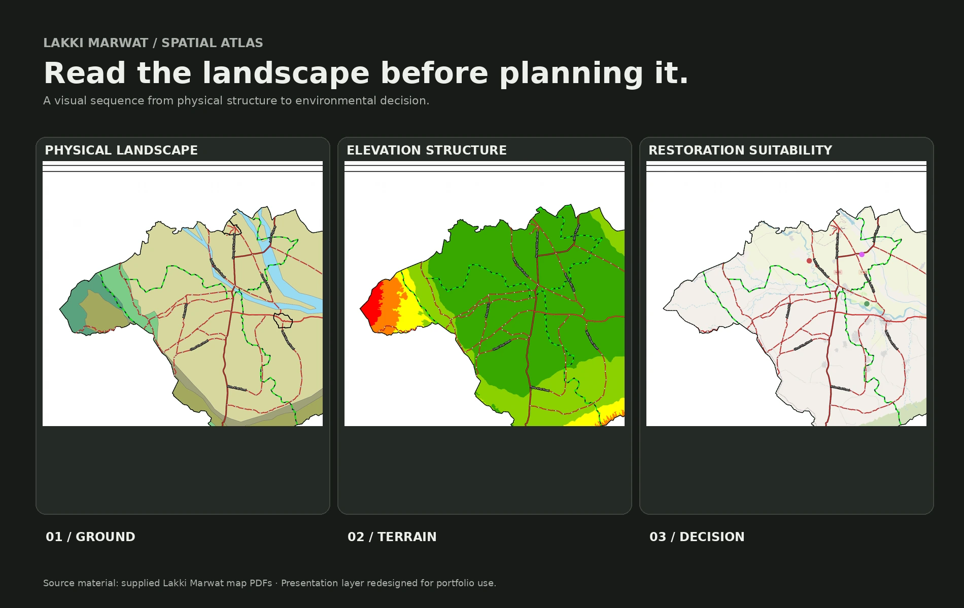
A spatial narrative
From inventory
to decision.
The supplied map series becomes more useful when read as a sequence. Each chapter answers a different question: what is the landscape made of, what pressures sit on it, where are the consequences, and where does the evidence point next?
01 / Ground
Read the ground first.
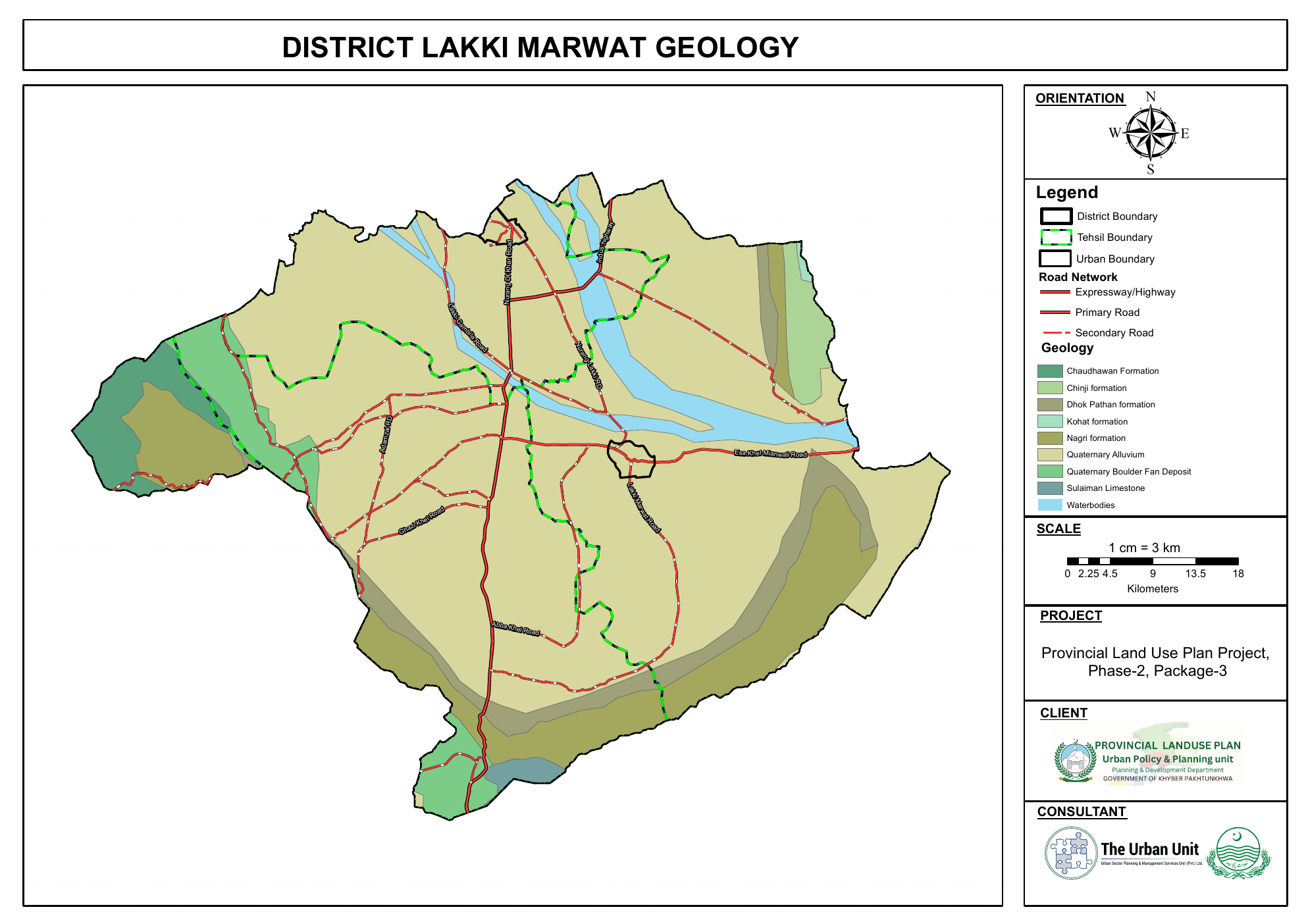
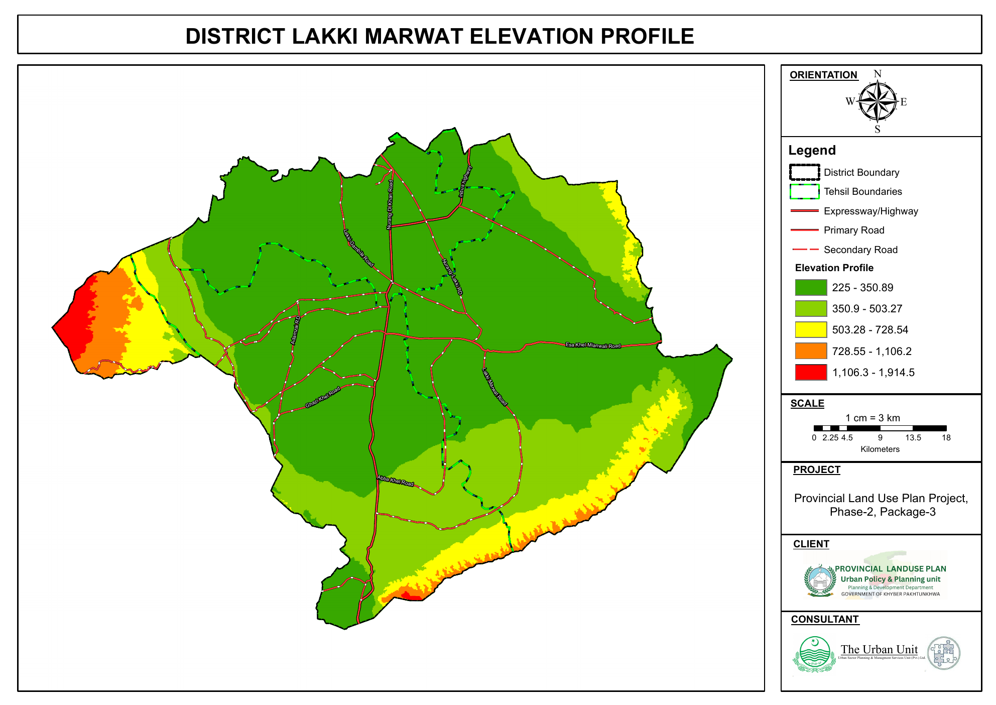
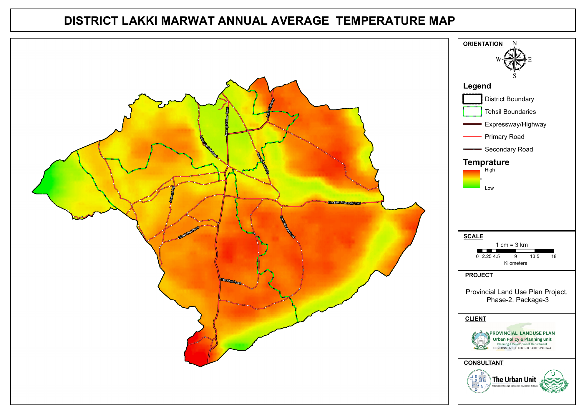
Geology, elevation and annual temperature establish the physical structure before environmental pressure or intervention is considered.
02 / Pressure
Map what is happening on it.
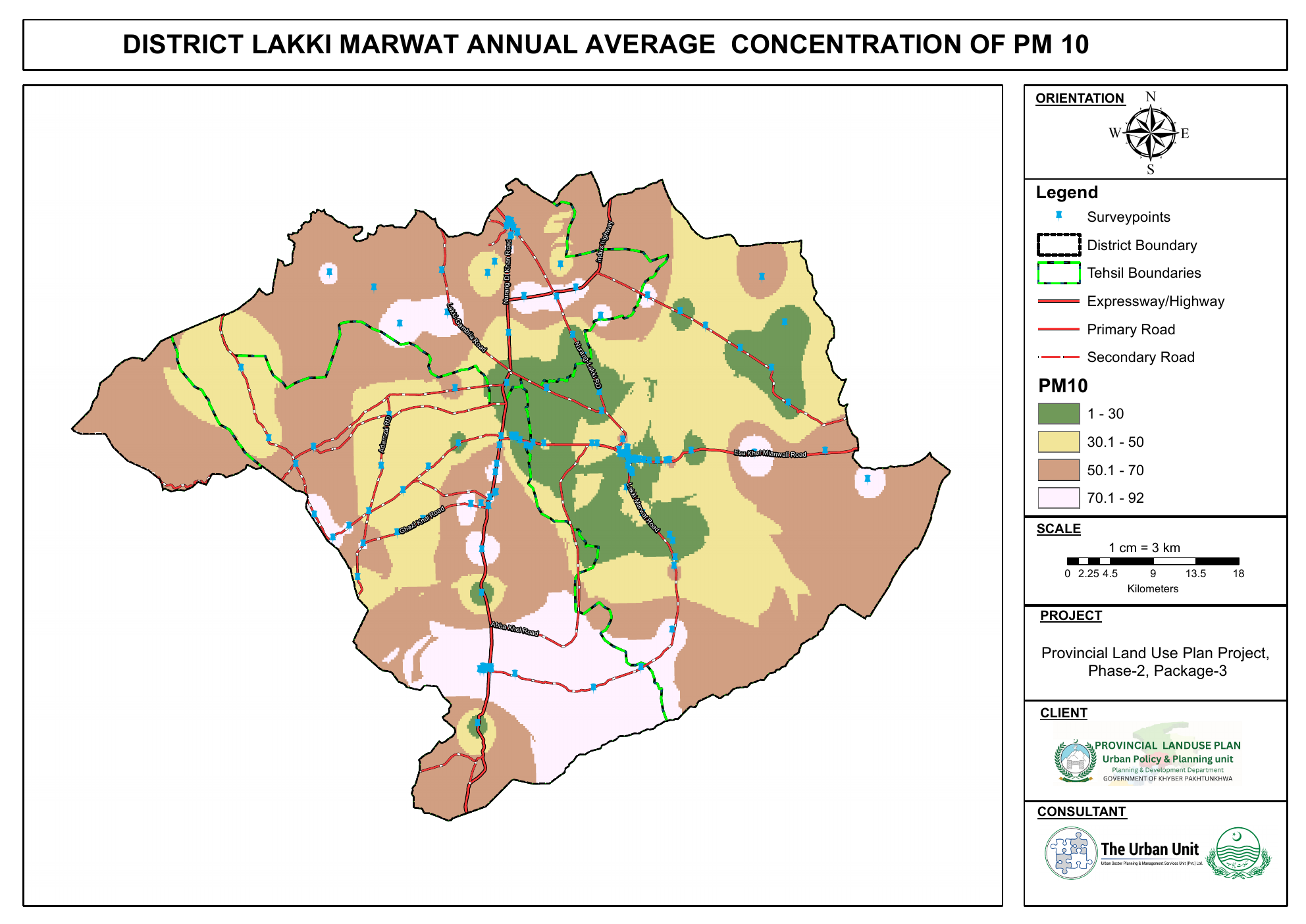
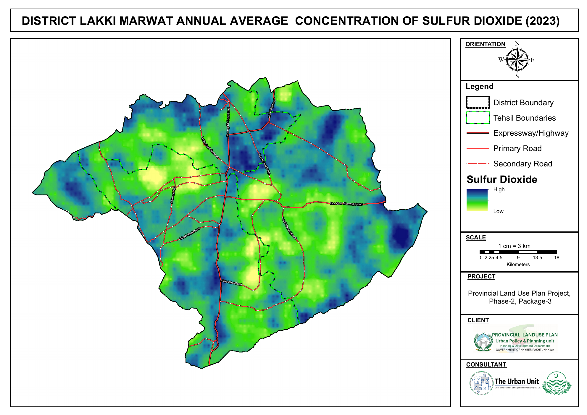
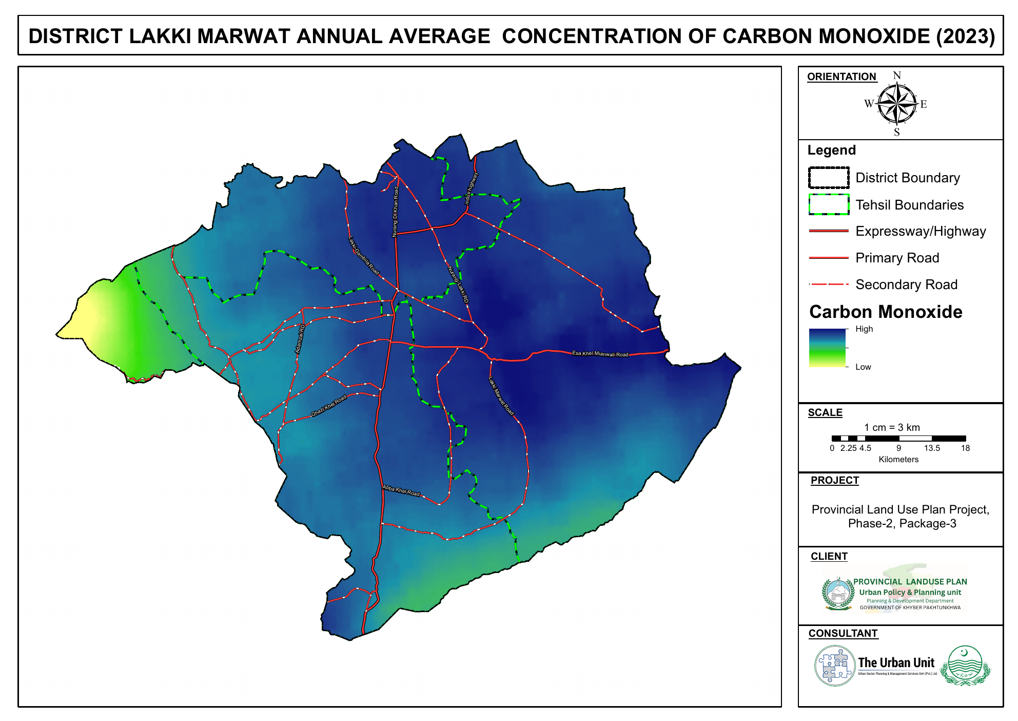
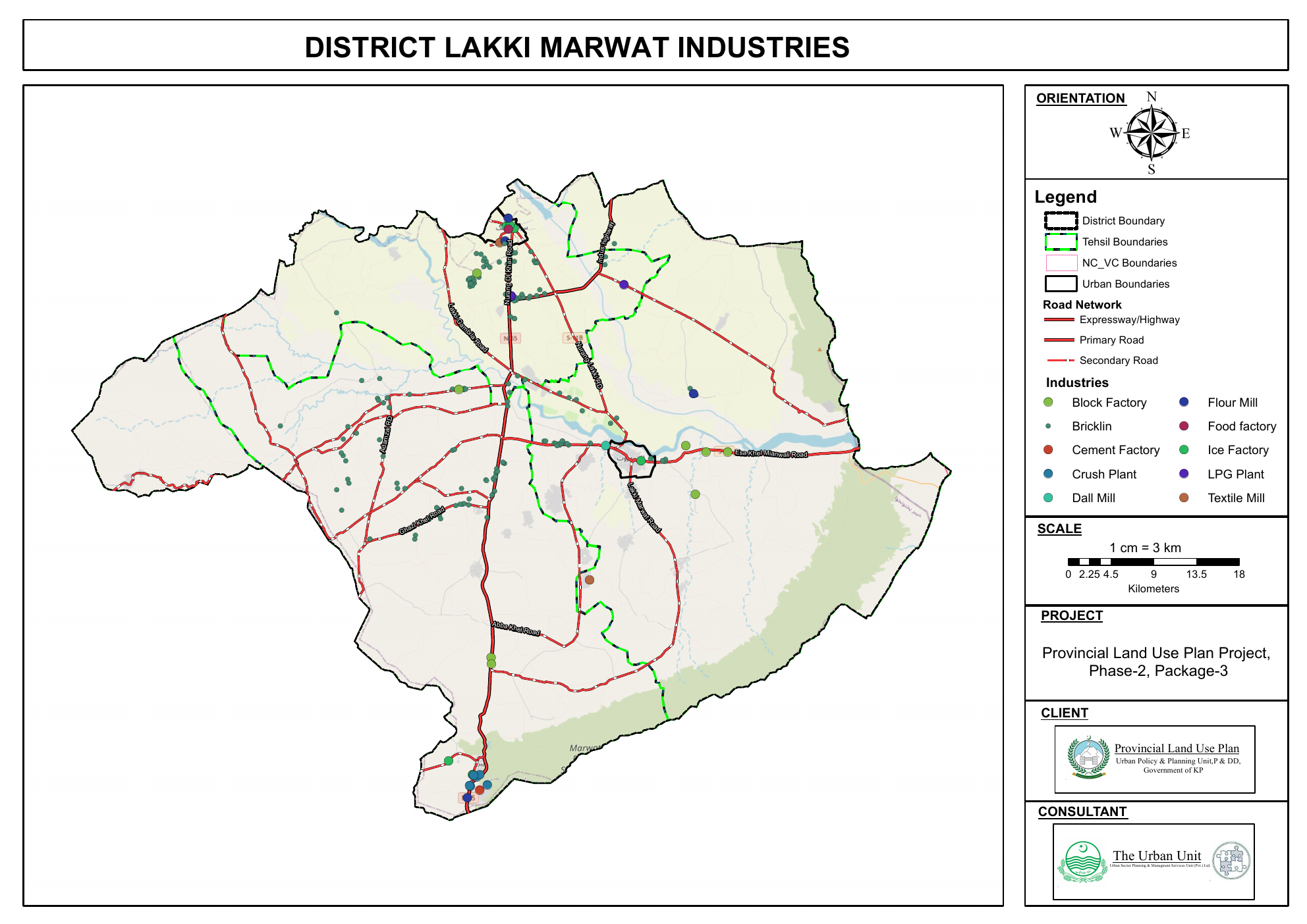
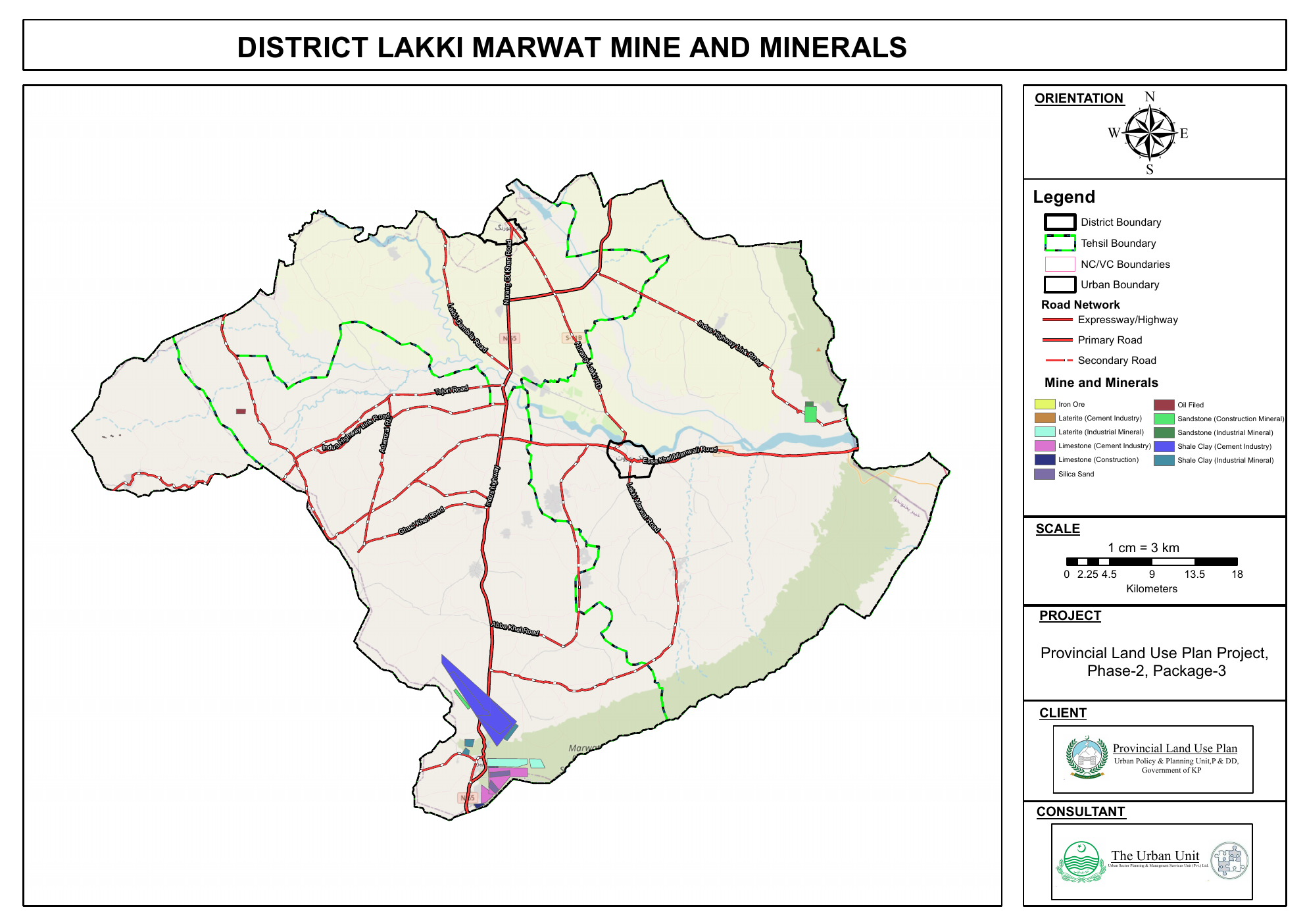
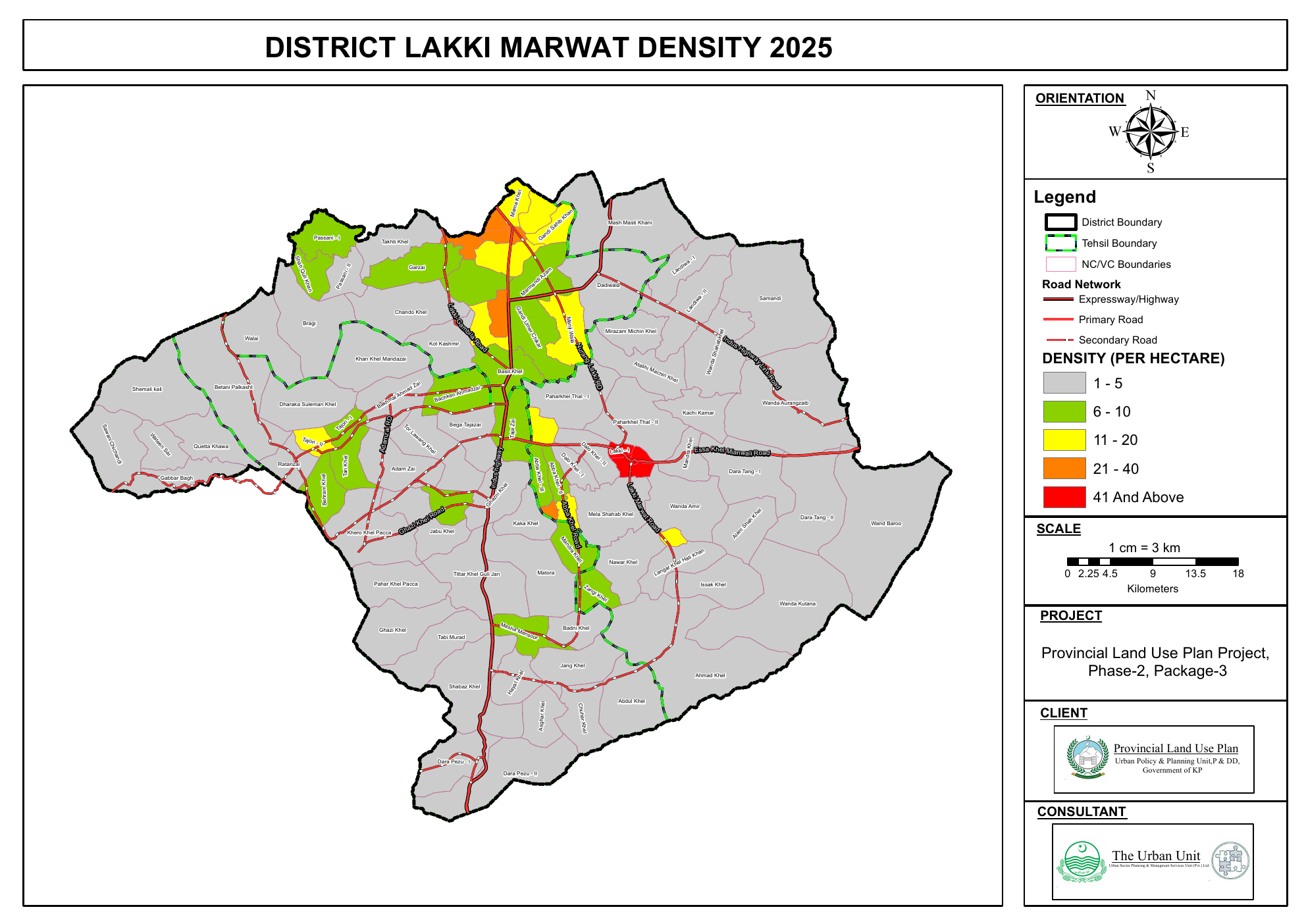
Air-quality surfaces and industrial activity reveal how environmental pressure and human activity sit across the district.
03 / Consequences
Where are the consequences?
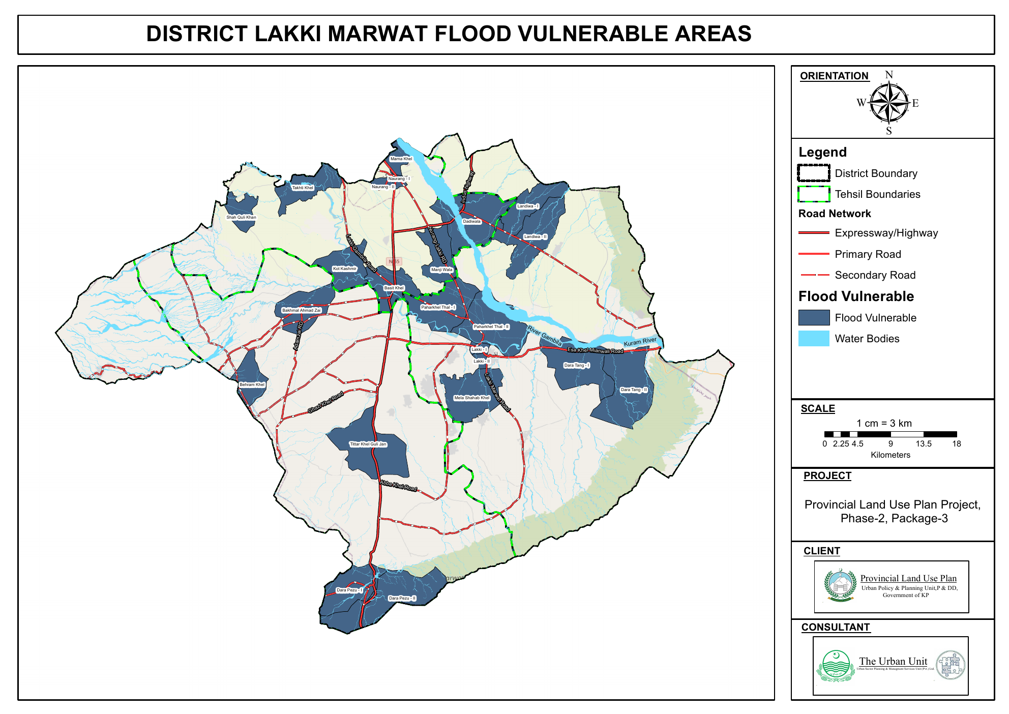
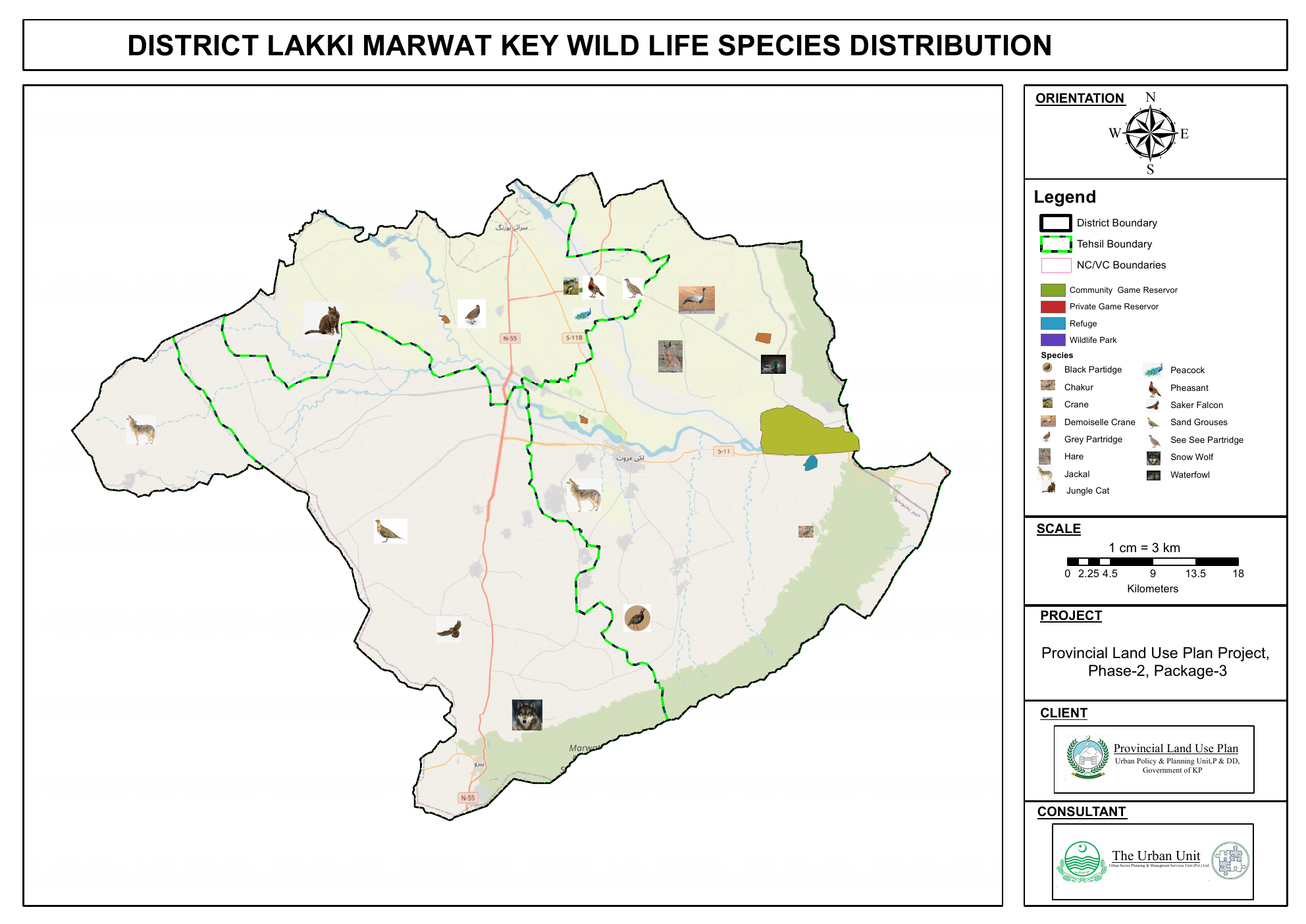
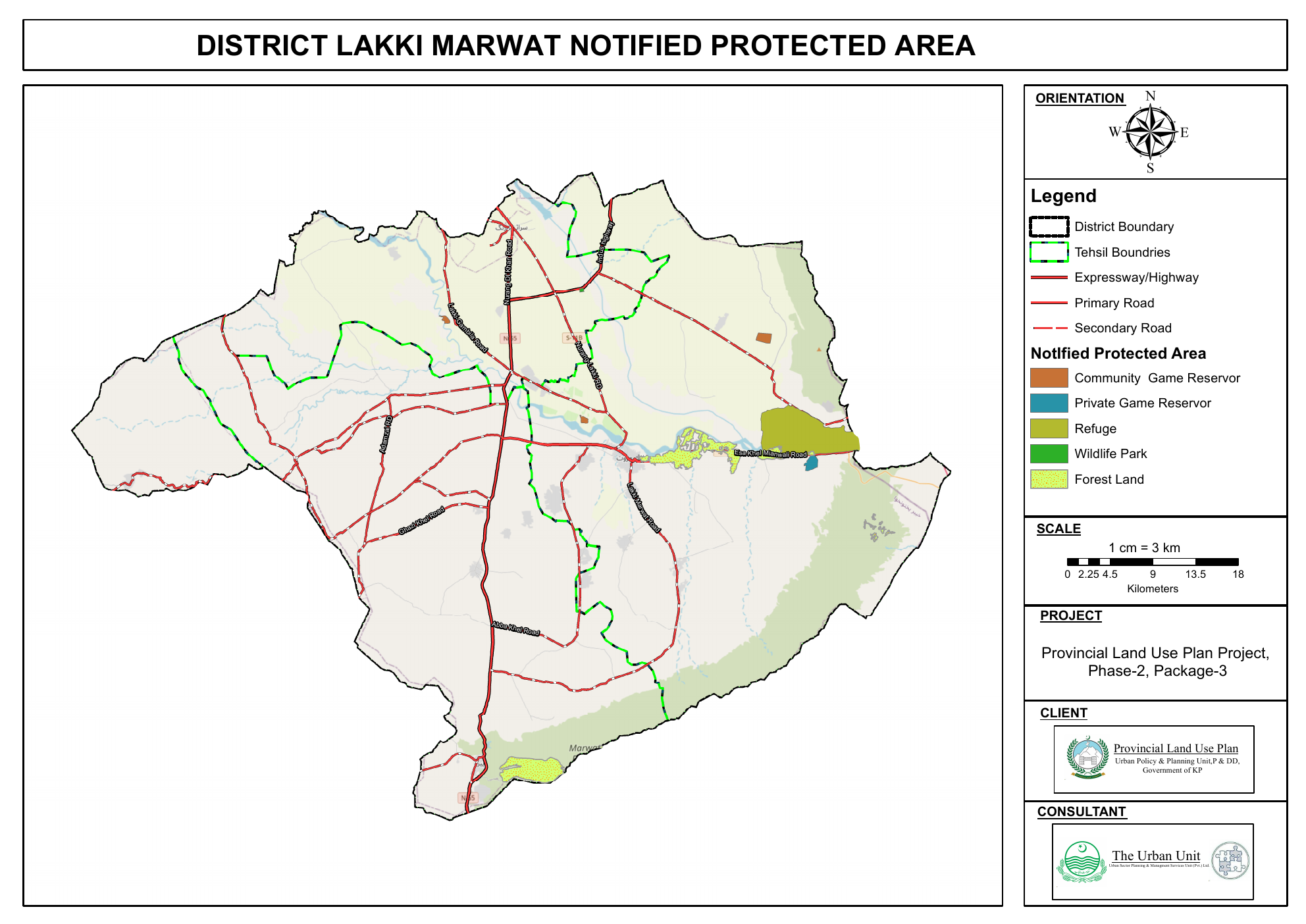
Flood vulnerability, wildlife distribution and protected areas shift the atlas from inventory toward risk and ecological value.
04 / Decision
Where does the evidence point?
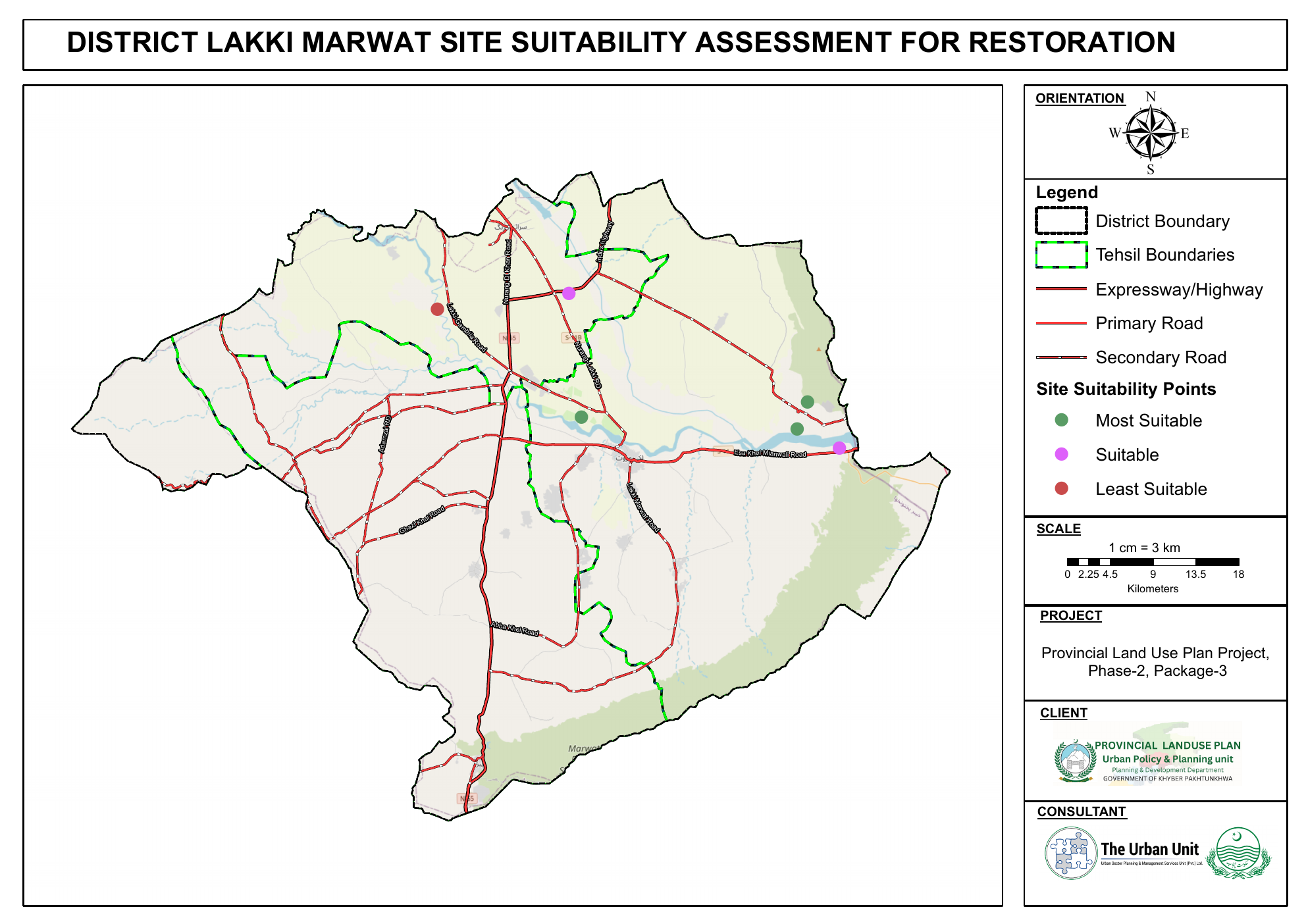
The supplied atlas closes with restoration suitability, turning the preceding inventory into a clear spatial decision surface.
Original evidence
Every plate stays
traceable.
The redesigned compositions are presentation layers only. The original supplied maps remain available below with their own legends, scale bars and cartographic context.
The final question